etna monti sartorius

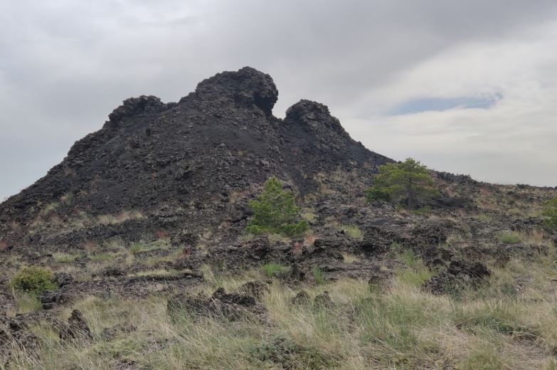
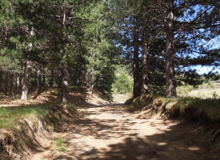
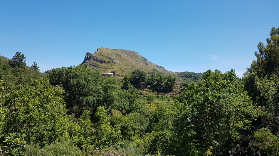
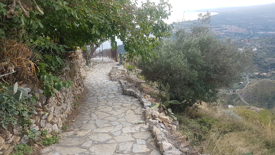
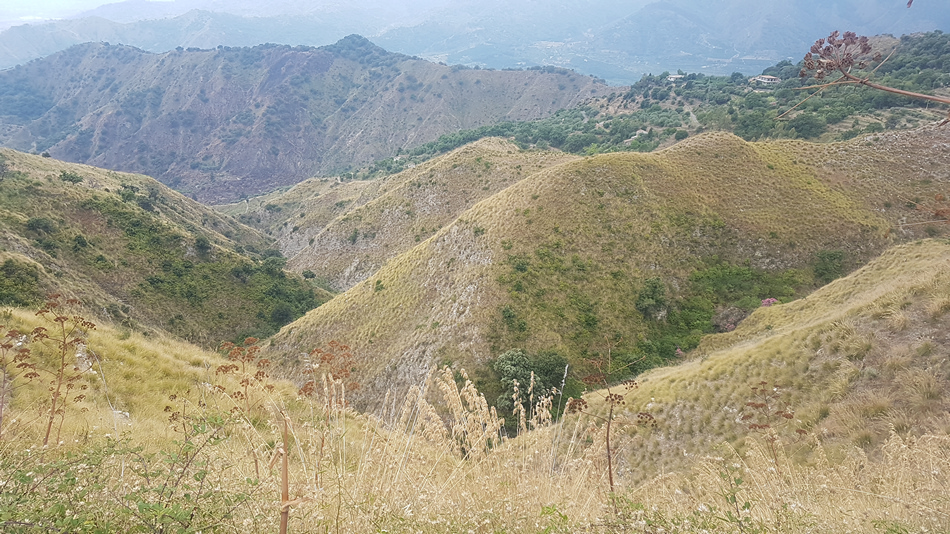
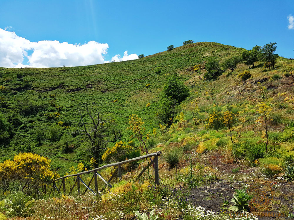
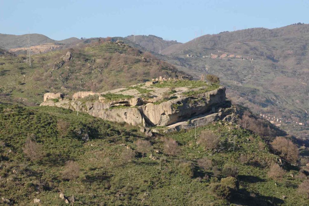
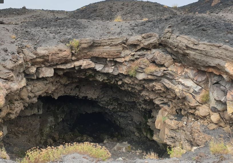
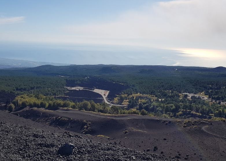
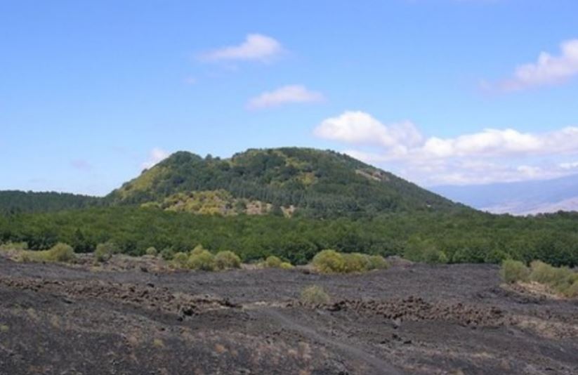
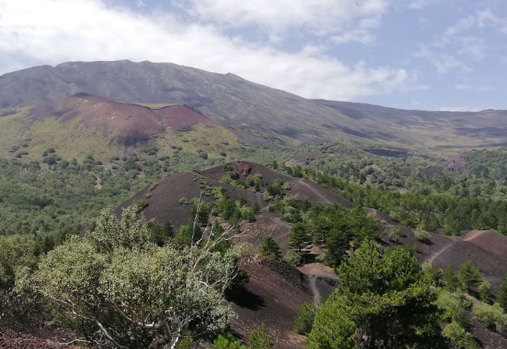
The Sartorius mountains on Etna are cone-shaped geological formations formed during past eruptions in practice represent ancient volcanic vents. Along the way you will meet 8 of which the last (or the first depending on whether you go to the right or left) is very impressive. The route starts from via Mareneve and goes along […]

Location:
Distance (a/r):
Km
Time:
h
Gradient:
m
Max slope:
%
Averege slope:
%
etna monte nero degli zappini

Its name is due to the Sicilian term which indicates the Pines present throughout the South Eastern park of the Etneo cone. The route is one of the oldest and most popular on Etna. It crosses lava flows of more recent eruptions, ie those between 1985 and 2001. As for all the paths that wind […]

Location:
Etna
Distance (a/r):
13.60 Km
Time:
5 h
Gradient:
200 m
Max slope:
21 %
Averege slope:
7 %
percorso parco dell'etna

The route is located on the north side of the Etneo cone near Piano Provenzana. Monte Nero is a large hemispherical relief made entirely of rock and lava sand. Its name derives from the grandeur of its shape and its characteristic black color. Photo by google The route crosses the lava flow that destroyed the […]

Location:
Etna
Distance (a/r):
7.7 Km
Time:
3.50 h
Gradient:
250 m
Max slope:
52.40 %
Averege slope:
13.70 %

Montalbano Elicona, a beautiful medieval town on the Nebrodi. The path runs alongside a dense forest located on this hill passing between small farms and plowed land. Photo by google The first section descends to the valley and then goes up and reaches the fortresses. These are rocks protruding from the ground with semi-horizontal road […]

Location:
Montalbano Elicona
Distance (a/r):
5.10 Km
Time:
2.00 h
Gradient:
150 m
Max slope:
32.00 %
Averege slope:
7.70 %
stazione ferroviaria di taormina

The route starts from the Hotel Montatauro where there are the stairs of the Madonna delle Grazie. Photo by alexintaormina Along them you go down the southern side of the promontory on which Taormina stands. Photo by alexintaormina This first section will end in Villagonia on the internal side. Photo by alexintaormina Going down the […]

Location:
Taormina
Distance (a/r):
5.20 Km
Time:
1.50 h
Gradient:
180 m
Max slope:
55.00 %
Averege slope:
13.00 %
isola bella taormina

The route starts from Porta Messina and continues towards Giardini-Naxos along via Pirandello. On this stretch the view is on the Messina side up to the Belvedere square. Photo by alexintaormina From this promontory you have a privileged view of Isola Bella and a panoramic point of view on both sides. Adjacent to the square […]

Location:
Taormina
Distance (a/r):
3.50 Km
Time:
1.20 h
Gradient:
180 m
Max slope:
60.00 %
Averege slope:
9.50 %
taormina versante valle d'agrò

More than a hiking route we can define it as a walk dedicated to photography. The route goes around the promontory of Taormina passing from the Etna side to the Messina side and vice versa. It starts from Porta Catania to continue on via Roma. Photo by alexintaormina Along it the view is on the […]

Location:
Taormina
Distance (a/r):
3.00 Km
Time:
1.00 h
Gradient:
50 m
Max slope:
40.00 %
Averege slope:
10.00 %
monte venera sopra taormina

The route is suitable for people with moderate resistance and used to traversing steep slopes. It starts from Porta Catania and through internal streets and the SP10 you reach the entrance of the Saracens climb. Photo by alexintaormina This ancient road led to Castelmola. Around it the lands were cultivated and represented a livelihood for […]

Location:
Taormina
Distance (a/r):
10.00 Km
Time:
3.50 h
Gradient:
650 m
Max slope:
49.00 %
Averege slope:
19.00 %
taormina via crucis

The route is short and slightly demanding. The departure is from Corso Umberto and continues towards the Zappulla area taking via Cappuccini. Near the elementary schools there is a sign for Salita Branco. Photo by alexintaormina This road runs along the north side of the promontory on which the ancient Norman Castle stands. This stretch […]

Location:
Taormina
Distance (a/r):
3.00 Km
Time:
1.00 h
Gradient:
150 m
Max slope:
49.00 %
Averege slope:
17.00 %
SP10 per taormina

The route starts from Piazza IX Aprile to continue towards Porta Messina. Take via F.lli Bandiera and Le Mura to reach the entrance of the Villa Comunale near the Montetauro hotel. Photo by alexintaormina Inside the villa continue along the central avenue to exit on the other side at the level of the Diodorus hotel. […]

Location:
Taormina
Distance (a/r):
14.00 Km
Time:
4.00 h
Gradient:
200 m
Max slope:
38.00 %
Averege slope:
5.00 %
taormina ziretto

A path that crosses one of the countryside areas of Taormina with tall eucalyptus trees. Photo by alexintaormina The route starts from Piazza Franz Pagano to go up in the area called Zappulla. From there you go down through a small Eucalyptus wood to the valley from where you start to climb. Photo by alexintaormina […]

Location:
Taormina
Distance (a/r):
8.00 Km
Time:
3 h
Gradient:
250.00 m
Max slope:
58.00 %
Averege slope:
11.40 %
taormina via saraceni

The route does not exceed one kilometer and climbs up the side of the town of Castelmola. Ancient way of communication between the two countries today it represents only a tourist route. Along it you will see the Saracen arch which was the gateway to enter the Castelmola area. At that time the whole area […]

Location:
Taormina
Distance (a/r):
6.00 Km
Time:
1.50 h
Gradient:
250 m
Max slope:
45.00 %
Averege slope:
22.00 %
le montagne di taormina

The route develops entirely on the Catania side of the mountains above Taormina. These areas are full of road routes rarely used but very interesting for those who love trekking or hiking. Photo by alexintaormina The route in question starts from under Mount Venera. The first part is downhill along the side of the mountain. […]

Location:
Taormina
Distance (a/r):
11.00 Km
Time:
4.00 h
Gradient:
250.00 m
Max slope:
33.00 %
Averege slope:
7.5 %
taormina strada montana

Luppineria is an area of ​​Castelmola in the mountains above Taormina. The area is rich in vegetation and paved paths. The one in question is along the road connecting with Melia. These roads are rarely frequented and especially by those who have land in the area. The start is under Monte Venera at an altitude […]

Location:
Taormina
Distance (a/r):
13.00 Km
Time:
3.00 h
Gradient:
150 m
Max slope:
29.00 %
Averege slope:
8.00 %
vulcano di mojo alcantara

Mojo Alcantara is an agricultural village within the Alcantara park a few kilometers from Taormina. Here stands an ancient volcano whose structure stands out for 700 meters. Photo by google Given the large presence of volcanic rocks throughout the Alcantara park, including the gorges and gorges, in the past it was thought that it was […]

Location:
Mojo Alcantara
Distance (a/r):
2.50 Km
Time:
1.00 h
Gradient:
110 m
Max slope:
46.00 %
Averege slope:
13.00 %
ruderi monastero san salvatore di placa

Just outside the town of Francavilla di Sicilia, 20km from Taormina, there is a fortress where a monastery was built. Photo by google The complex, built around 1093, was dedicated to San Salvatore di Placa and represented a fortified monastery. Photo by google Its origins are of Byzantine nature and today only a few overhanging […]

Location:
Francavilla di Sicilia
Distance (a/r):
3.00 Km
Time:
1.00 h
Gradient:
100 m
Max slope:
31.00 %
Averege slope:
11.00 %
ruderi castello ruffo

In the past in the town of Francavilla di Sicilia a castle was erected on the highest point. Photo by google From here it was and it is possible to see the entire Alcantara valley including the gurne which are right under the mound. Photo by google The castle was built in the Norman period […]

Location:
Francavilla di Sicilia
Distance (a/r):
1.50 Km
Time:
1.00 h
Gradient:
100 m
Max slope:
53.00 %
Averege slope:
21.00 %
gurne francavilla di sicilia

The Alcantara river flows almost entirely on a bed of lava rocks. Small lakes called gurne are formed along its path. This route passes among those present in the municipality of Francavilla di Sicilia just 40 minutes from Taormina. The route starts from the town and is very easy and well signposted. After three hundred […]

Location:
Francavilla di Sicilia
Distance (a/r):
3.50 Km
Time:
1.00 h
Gradient:
50 m
Max slope:
40.00 %
Averege slope:
8.00 %
gurne castiglione di sicilia

In this stretch of the river the water flows over a bed of volcanic rock. Lakes called gurne are formed along its bed. Photo by google The route runs along the Alcantara river for the entire stretch, passing over the lava rocks. Along it the rapids slow down and accelerate near the small lakes that […]

Location:
Castiglione di Sicilia
Distance (a/r):
3.20 Km
Time:
1.00 h
Gradient:
80 m
Max slope:
26.00 %
Averege slope:
5.10 %
sentiero dei patriarchi malabotta

It is the most beaten and famous path of the Malabotta wood. So called because it crosses an area where there are the oldest trees in the entire wooded area. The itinerary is clearly visible and indicated and has several variations in slope going down and up several times from the various peaks or laces. […]

Location:
Bosco Malabotta
Distance (a/r):
8.50 Km
Time:
3.00 h
Gradient:
150 m
Max slope:
46.00 %
Averege slope:
10.10 %
ruderi convento san giacomo

The route is located inside the Nebrodi and winds through a wood. The starting point may vary as from the SS116 it is possible to enter for a while by car. We are about 1200 meters above sea level and the climate is alpine. The path is clearly visible and is in clay. Along it […]

Location:
Santa Domenica Vittoria
Distance (a/r):
13 Km
Time:
5.00 h
Gradient:
220 m
Max slope:
65.00 %
Averege slope:
12.90 %
za draga roccella valdemone

Roccella Valdemone is a small village on the border between the Alcantara Park and the wooded area of ​​the Peloritani. Photo by google It is located near the wonderful Malabotta wood and the Argimusco megaliths. The route starts from the SP2 and is equipped with a parking area and a wonderful area equipped for adults […]

Location:
Roccella Valdemone
Distance (a/r):
2.00 Km
Time:
1.5 h
Gradient:
220 m
Max slope:
60.00 %
Averege slope:
24.20 %
rocca salvatesta novara di sicilia

Rocca Salvatesta together with Rocca leone form two spurs on a rock formation in the Peloritani park. The two peaks rise 1250 meters above sea level and are located near the town of Novara di Sicilia. Photo by google The route, clearly visible from the traces on the ground, starts from the SS185 easily reachable […]

Location:
Novara di Sicilia
Distance (a/r):
6.14 Km
Time:
3 h
Gradient:
345 m
Max slope:
48.00 %
Averege slope:
13.60 %
le grotte dell'etna

The whole area of ​​the Etna cone is scattered with caves, small tunnels and holes in the ground. These are the result of volcanic activity. During the flow of fluid lava, the top part cools faster than the internal one. In this way, fluid lava tunnels are formed under the crust. At the end of […]

Location:
Etna
Distance (a/r):
21.40 Km
Time:
10 h
Gradient:
700 m
Max slope:
40 %
Averege slope:
10 %
etna buche da impatto

This route starts from the highest part accessible by car, Piano Provenzana. We are on the northeast side of the volcanic cone. This area was equipped with a nice hotel restaurant and a ski lift. The eruption of the almost totally destroyed this area. It was rebuilt but the charm it had disappeared with that […]

Location:
Etna
Distance (a/r):
9.50 Km
Time:
4 h
Gradient:
620 m
Max slope:
30.00 %
Averege slope:
13.00 %
monte spagnolo etna

The route is located in the northern part of the volcanic cone near the town of Randazzo. Monte Spanish is a large conical formation representing an ancient effusive mouth. Photo by google There are actually two conical formations of which the most imposing is Monte Spanish. The route includes the crossing of lava flows dating […]

Location:
Etna
Distance (a/r):
8.60 Km
Time:
4 h
Gradient:
550 m
Max slope:
27.00 %
Averege slope:
12.60 %
Cisternazza Etna trekking

The cisternazza is a typical circular Etnean structure that protects a well about 15 meters deep. The path will reach this structure through woods and lava flows. Photo by google The only structure of this type existing in the Etna park, it is located next to another structure used in the past by local shepherds. […]

Location:
Etna
Distance (a/r):
9.80 Km
Time:
4 h
Gradient:
400 m
Max slope:
24.5 %
Averege slope:
9 %
salita dei saraceni taormina

The route allows you to get to Castelmola starting from Taormina. Panoramic route full of curiosities. The departure is from piazza 9 Aprile. Photo by alexintaormina Continue to Porta Catania and from there go up to reach via Rotabile Castelmola. Along this road we will use a couple of shortcuts that allow us to reduce […]

Location:
Taormina
Distance (a/r):
5.00 Km
Time:
1.50 h
Gradient:
300 m
Max slope:
50.00 %
Averege slope:
16.00 %